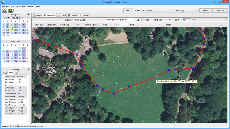
This project featured a custom, client-server mapping application with maps of 193 countries. Using standard, aerial and hybrid maps, users can map running, walking and cycling routes without GPS, on or off-road, through woods, along walkways, across backyards and even over buildings. We implemented this using a free source of mapping data, but created our own custom tiling system using a Mercator projection. Tiles are are much larger, they are cached (they don’t need to loaded twice) and scrolling is very fast.
Project Details